


|
|
|
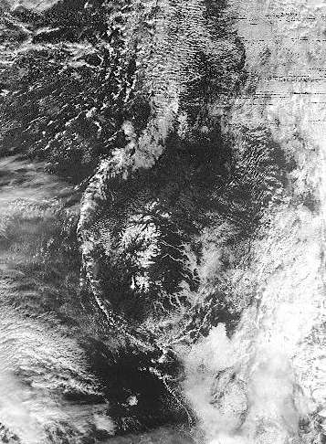
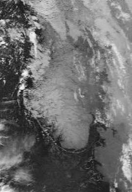
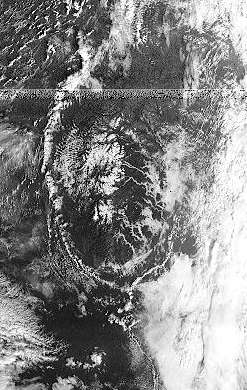
These three images were gathered on Friday October 20, 2000, in the (local) morning time. They show outlines around the coast of Norway, almost as if some sort of image enhancement technique has been used, but they are not so processed. It seems that some meteorological phenomenon is responsible. If you can help, I'd be happy to publish your explanation here... Note that the image is shown from three satellites - the far-IR channel of NOAA-12 (10µm), and the visible channels of Meteor 2-21 and Resurs O1-N4. On the visible channels you can clearly identify the snow on the Norwegian mountains, and Mark Conner has suggested that fog may be responsible for the light colouring in the river valley areas, following the lines of the rivers. He also comments: "There is also a convergence line of clouds just off the coast, possibly caused by colder air draining off the land over the warmer water." These also show up clearly in the infra-red image. Such lines around the coast are quite unusual.
| ||||||
|
|