


|
|
|
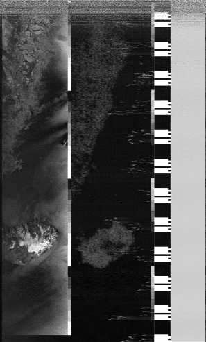
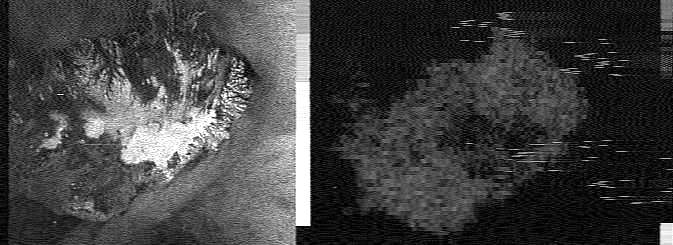
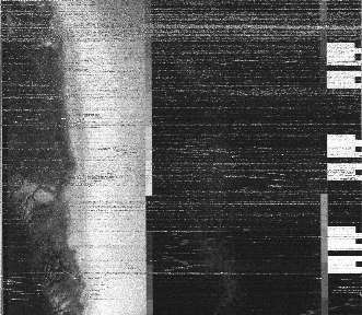
I received these satellite signals on Tuesday, April 20, at around 02:07 UTC. The only orbit I can see that's near is Okean 1-7, but the pictures don't seem to quite match what I have seen before. I wonder if anyone could confirm the satellite? Could this be the west coast of Greenland, and if so, are there any details of view angle etc. available? Many thanks to those responded - I have confimed the satellite as OKEAN because of the "piano key" black and white bars, and given an adjustment of the image aspect ratio on a different run, Greenland it is! Iceland by Radar
Original Puzzle PicturesThe pictures are broken as the receiver I'm using (an RX2) does not seem to lock onto the signal properly. I've put the pictures into an order corresponding to a northbound pass, and trimmed off the 42msec of 1200Hz sync tone.
| ||||||||||||
|
|