First ever South Atlantic Hurricane
| Image - 1
|
Image - 2
|
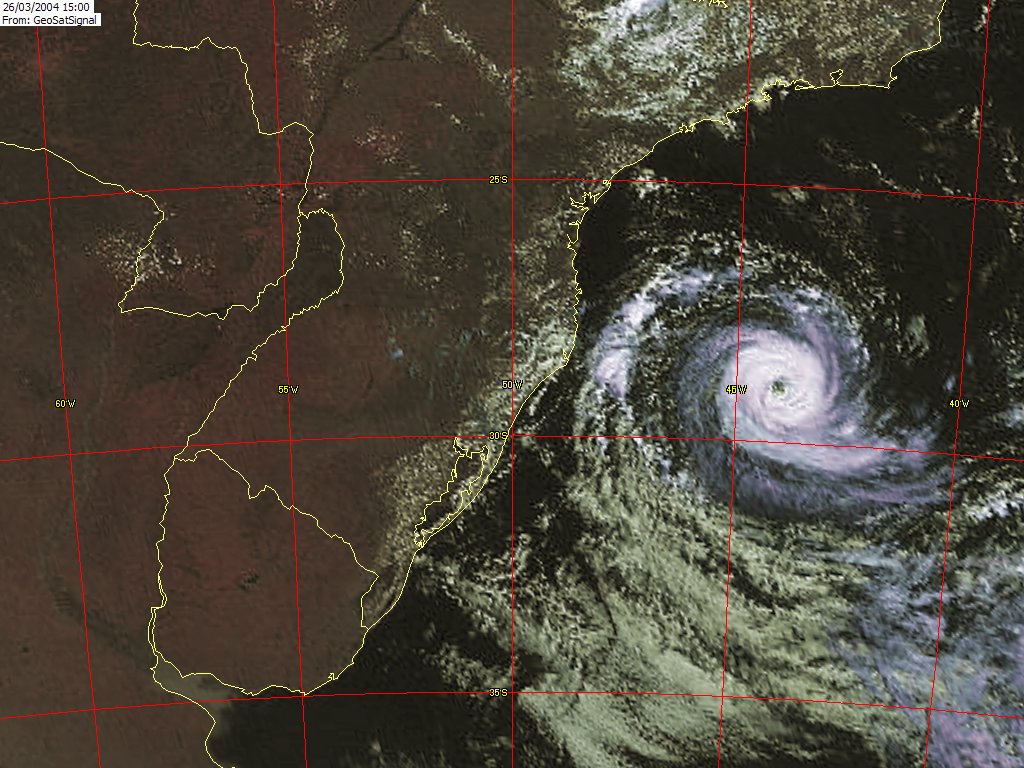
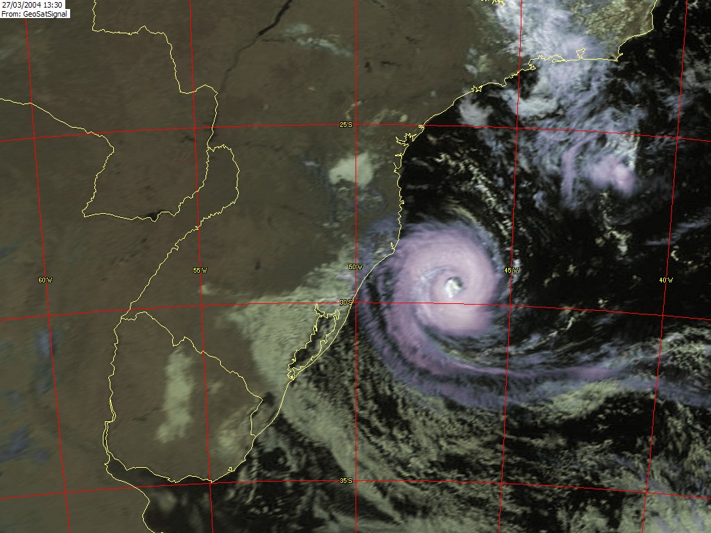
Image Details:
Image 1
This image shows what has been reported as the first ever South Atlantic hurricane. The data was captured by the NOAA GOES-12 satellite at 15:00 on 2004 March 26, and relayed through EUMETSAT's EUMETCast service. Processing was by my MSG Data Manager and GeoSatSignal software.
The full image shows the South American coastline, with Buenos Aires and the River Plate in the south west corner.
Image 2
This image shows development over about one day. The data was captured by the EUMETSAT Meteosat-7 satellite at 13:30 on 2004 March 27, and relayed through EUMETSAT's EUMETCast service. The full image shows the South American coastline, with Buenos Aires and the River Plate in the south west corner, with the same projection as Image 1.
More information:
IOL:
http://www.iol.co.za/index.php?click_id=3&art_id=qw1080374767779B236&set_id=1
USA Today:
http://www.usatoday.com/weather/hurricane/2004-03-26-brazil-hurricane_x.htm