Metop-A image of New Zealand
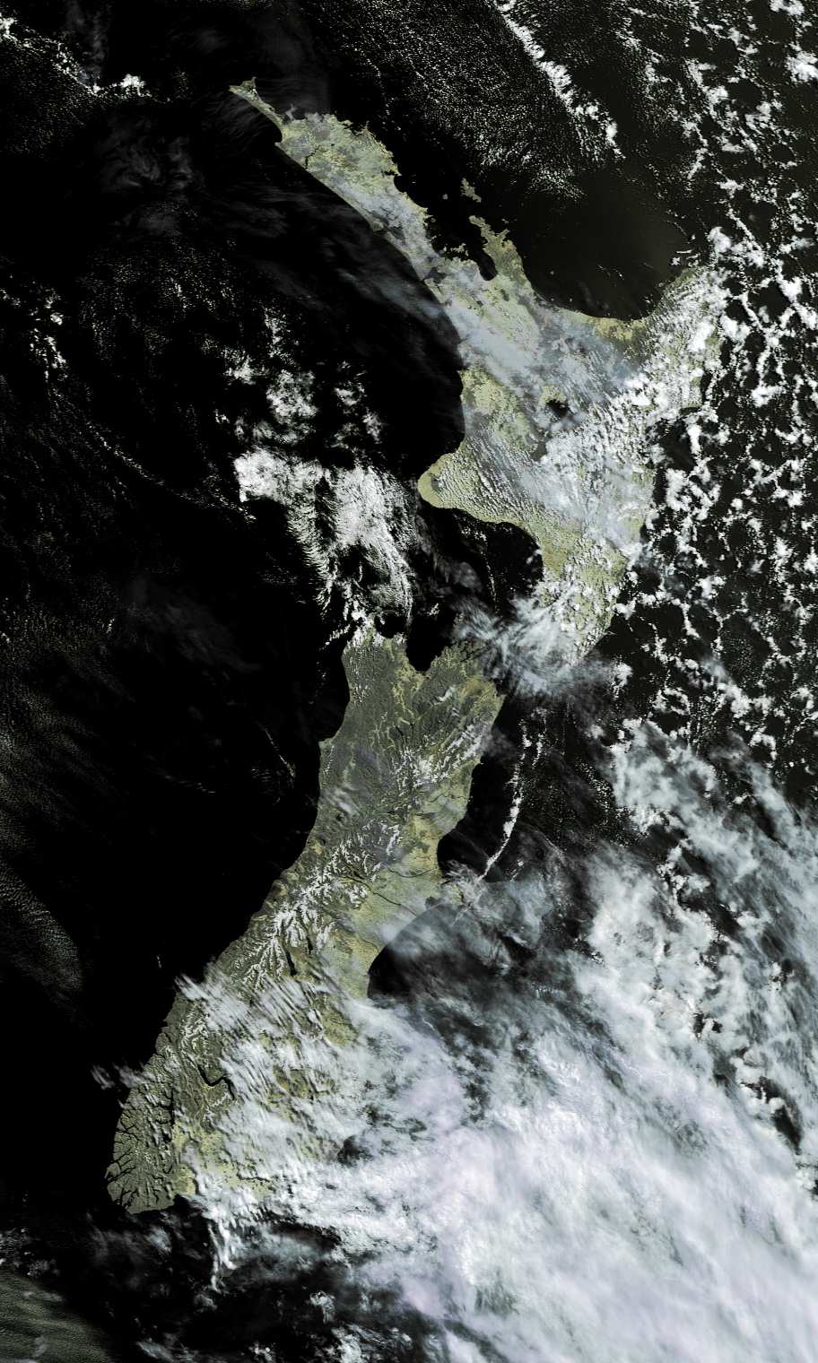
This image of New Zealand uses my Metop Manager software to process chunks of EPS Global data from EUMETSAT's Metop-A satellite (launched in October 2006) and combine them for display in my HRPT Reader software. This false-colour image uses brightness data from the 0.8µm visible channel of NOAA's AVHRR instrument, and the colouring is derived from the 10µm thermal channel. This data was acquired on 2006 Dec 09, downloaded to the Svalbard ground station about half an orbit later, processed, and then sent out to hundreds of users over the EUMETCast system.