SatSignal at Work
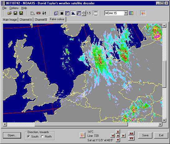
This scaled down and compressed screen-shot shows SatSignal at work using a mode developed by a user in which the temperatures of cloud tops are presented as different colours to indicate approximate rainfall amounts. The overlay facility has been used to mark the land and sea areas and provide a latitude and longitude grid. The infra-red channel of NOAA-15 has been processed into temperatures. Where there is no cloud or warm cloud tops, the land outline itself is shown.