North Wales - 2009-March-18 - Striking HRPT images
NOAA-15 happened to be passing overhead North Wales late in the afternoon of March 18, when the sun was at a low angle and hence produced some very striking images. Those taking the free DWDSAT HRPT data from the EUMETCast service will have already seen the striking quality of this data (thanks to Angus Crawford for pointing this out to me), and Robert Moore has submitted his locally received data. The DWDSAT images here have been processed by my DWDSAT HRPT Viewer, and enlarged by a factor of three to match Robert Moore's image.

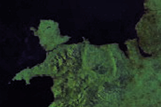
False-colour image derived via my own technique of using the 0.8µm data for the visible component and thermal data for the colour component. |
False-colour image using channel 1 for red, channel 2 for green, and channel 4 for blue, sometimes called RGB124. |
Image Interpretation
Robert Moore commented on the GEO-Subscribers self-help group:
"I spent most the time between morning and later afternoon meetings today sunning myself on the Great Orme. Meanwhile NOAA15 passed at 1617 just as the Sun was modelling the contours of N. Wales in a way I had never seen before. I have posted a picture based on the 'Timestep' false colour.
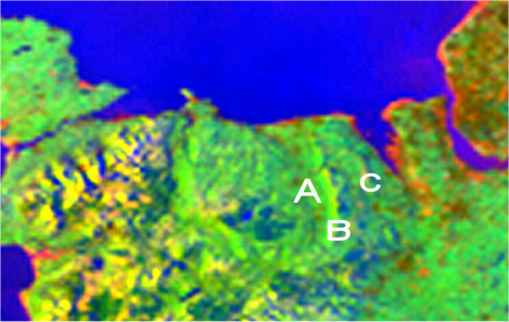
"Snowdonia is very clear to see but also the vale of Clwyd (A on my image) the Clwydian range (B) and the Halkyn Mountain (C) - I live on the northern edge of (C) and have never before seen it in satellite imagery.
"Apologies to non-UK members - the Great Orme is a spectacular limestone outcrop with the sea on three sides - see the little blip on the coast in the middle of the image. The archaeology, natural history and geology are very special (and some mad people even climb the rocks)."